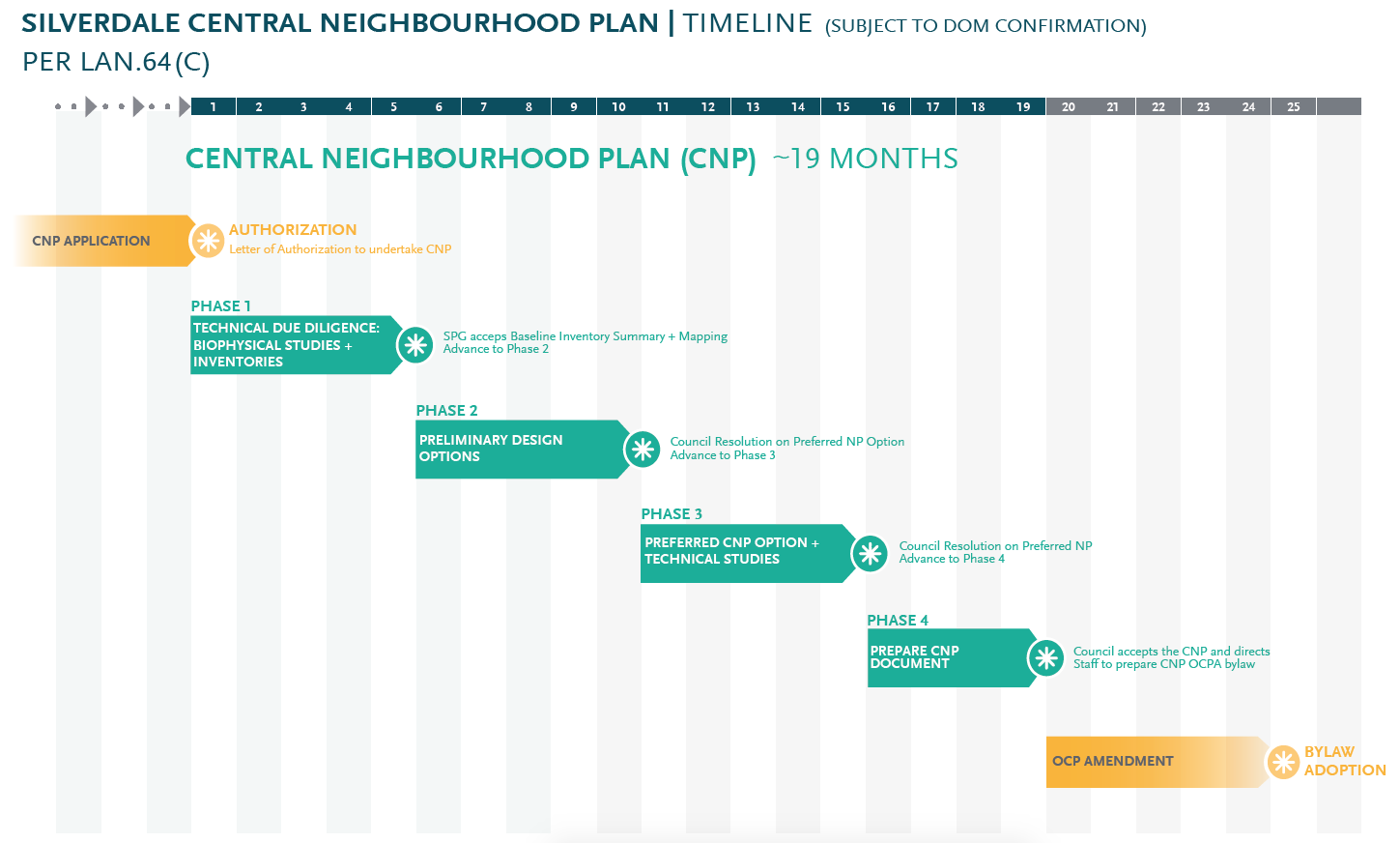
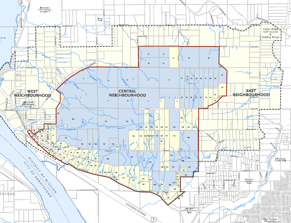
On July 20th, The District of Mission enthusiastically approved Polygon's Application for a Proponent Led Land Use Plan. Under the new LAN64 bylaw, a 60% approval threshold had to be met to initiate a proponent led method. In the application, Polygon's total ownership stake of the Central Neighbourhood totalled 69%. The estimated timeline to a preferred land use plan is 19 months, however draft land use plans will be released much sooner which will offer a glimpse into how the land will take shape.
We've included some media below with brief descriptions of what they represent. Feel free to reach out to us if you'd like clarification on something happening in Silverdale or if you're curious about land prices in general.
Timeline for Silverdale's Central Neighbourhood Land Use Plan

Polygon's holdings in blue, which made up the 69% stake.

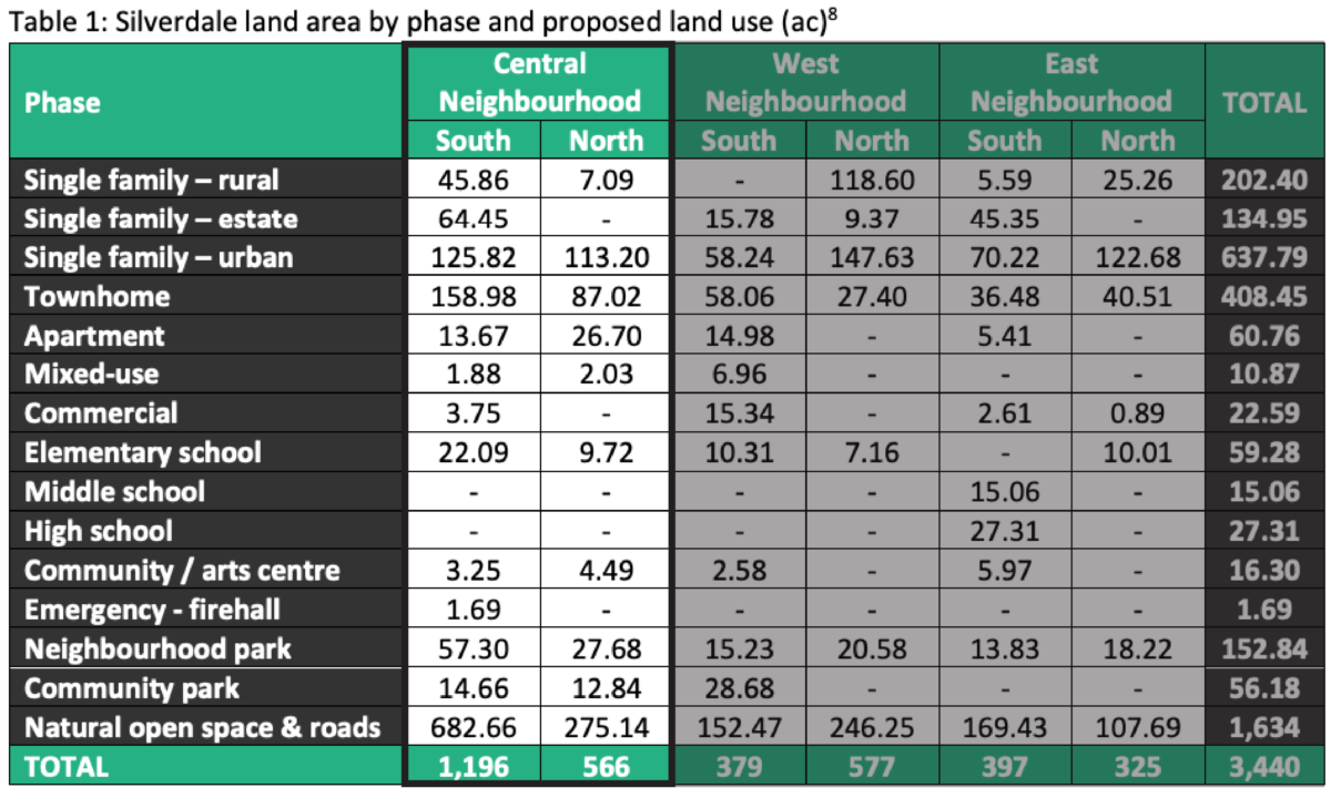
The Central Neighbourhood is broken down into two portions, Central North and Central South as shown below.

Breakdown by acre of the Central Neighbourhood Land Mass

Breakdown by possible units, these are strictly estimates based on the Master Infrastructure Strategy

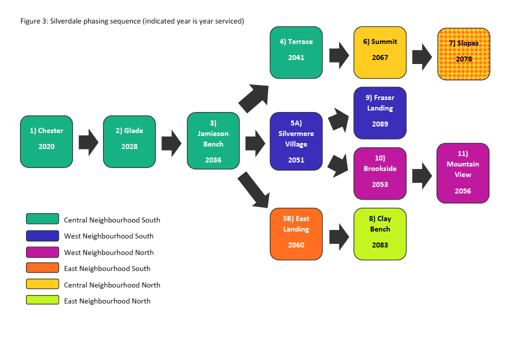
Rough timeline estimates to each area being serviced, these are likely optimistic by 12-24 months being as servicing work has yet to begin.

